Understanding the FEMA Flood Insurance Rate Map
Here's how to understand zoning codes so you can locate the coverage you need.

Christine Lacagnina has written thousands of insurance-based articles for TrustedChoice.com by authoring consumable, understandable content.
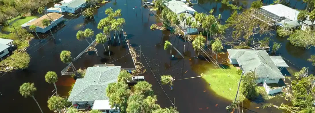
Purchasing a house right off the coast can offer several advantages, like a relaxing environment and many fun outdoor activities. However, one potentially large disadvantage is the increased risk of flooding. Just one bad storm could possibly leave your oasis in a soaking mess, both in terms of water damage and financial damage.
Before you buy your dream house on the coast, it's a good idea to learn all about the FEMA flood insurance rate map and learn about flood zones. Independent insurance agents are also here to help by eliminating confusion and finding the right flood insurance policy for you. First, though, here's more about the FEMA flood insurance rate map.
What Is the FEMA Flood Insurance Rate Map?
The FEMA flood insurance rate map displays communities in the U.S. and indicates elevation levels and designated flood zones. The different zones indicate the appropriate insurance premiums for specific properties.
Homes in high-risk areas will be subject to higher premiums than homes that may be close but are not marked as high-risk. Costs are associated not only with flooding history but also with the risk of future flooding.
Here are the major categories on the FEMA flood insurance rate map:
- Flood Zone A: These are inland flood zones or areas that are not near the coast but have a risk of flooding.
- Flood Zone V: These are beach zones or areas that see a trend of wave action and are therefore at higher risk of flooding.
- Flood Zone X: These areas are not expected to flood or are remote areas.
- Flood Zone AE: These are areas that have a 1% chance of inundation by an annual flood event.
- Flood Zone VE: These are areas that have a 1% chance of inundation by an annual flood event, as well as additional hazards caused by wave action due to storm-induced velocity.
- Flood Zone AO: These are areas that are usually sheet flow on sloping terrain and have a 1% chance of an annual shallow flooding event. The average depth of these flooding events is between one and three feet.
Curvy lines on the map indicate how high water in a certain area has the potential to get. The map also indicates the percentage of likelihood of the water actually reaching that height in a given year.
Save on Flood Insurance
Our independent agents shop around to find you the best coverage.
How Does FEMA Determine a Community's Risk Level?
FEMA determines a community's risk level based on past experience with observing flooding and storm trends for different locations. It also consults hydrology studies, changes in flood maps, and changes within the communities. Communities with rapidly growing populations will be subject to new development, which could alter water's route during a flood. FEMA may work with a city on projects to reduce the risk of flooding, like building levees.
Finding Your Flood Zone Designation
Locating your specific flood zone online is easy, thanks to FEMA's official website. Visit FEMA's Flood Map Service Center and input your address to pull up the map of your community. You'll be able to see which flood zone you're in and nearby zones and potential flood hazards in your area.
Can I Change My Flood Zone Designation?
No, your flood zone designation cannot be changed. However, you can change your home's elevation, which could reduce the cost of your flood insurance premium.
Flood insurance requirements involve measuring the elevation of the bottom of your home's lowest floor above sea level. The greater the distance, the less the property's risk of flooding. Once an area has flooded multiple times, FEMA may take action to require that the city dictate you cannot rebuild property in that location unless it's elevated.
Are Flood Insurance Costs Different by Each Flood Zone?
Flood insurance costs can vary dramatically by flood zone. Living closer to the water leads to a much more expensive policy than a town or two over from a lake, ocean, or river. However, houses near the shore that are built on stilts tend to have lower premiums than their ground-level neighbors. Any action taken to reduce flooding risk can also lead to savings on flood insurance.
You won't be able to determine how much your insurance will cost just by looking at FEMA's flood insurance rate map. A professional will have to decipher the cost for you based on the zone you're in and additional markings indicating flooding risk levels. A local independent insurance agent can help with this.
Save on Flood Insurance
Our independent agents shop around to find you the best coverage.
Why Work Together with an Independent Insurance Agent?
Browsing available options for flood insurance can be a confusing and time-consuming task. Independent insurance agents can help greatly simplify the process. These agents can shop and compare policies from multiple carriers for you.
Ultimately, they'll match you to the right policy that offers the best overall blend of coverage and cost. And down the road, they'll be there to help you file claims or update your coverage as necessary.
https://www.floodsmart.gov/understanding-my-flood-zone
https://www.fema.gov/flood-maps/coastal/insurance-rate-maps
https://www.floodsmart.gov/all-about-flood-maps